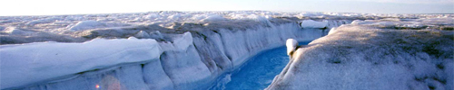
The Extreme Ice Survey (EIS) is a coordinated effort to visually study and document rapidly changing glaciers around the world using time-lapse photography, conventional photography, and video. Sponsored in part by NASA, the National Science Foundation, and National Geographic, the EIS utilizes 27 cameras installed at 15 sites including Greenland, Iceland, Alaska, and the Rocky Mountains, supplemented by annual repeat photography in Iceland, the Alps, and Bolivia.

Figure 1: EIS Locations; Graphic Credit: EIS
Led by James Balog, a nature photojournalist with National Geographic, the EIS teams consist of imagemakers, engineers, and scientists focused on understanding glacial change. Each camera is configured to take one photo an hour during daylight hours, accumulating approximately 4,000 images a year. The images are then edited together to form video documentation of the changes over time. The project is expected to generate nearly 500,000 images by its completion.
The project has generated a NOVA television documentary, “Extreme Ice”, and an accompanying book, Extreme Ice Now.
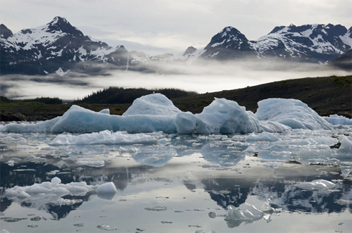
Figure 2: Columbia Bay, Alaska; Photo Credit: EIS
Additional Reading
- “The Big Thaw” – National Geographic, June 2007
- Extreme Ice Survey (EIS)
- “Extreme Ice” – PBS NOVA
- Extreme Ice Now – James Balog


Discussion
No comments yet.